A geodetic survey measures the Earth’s shape and gravity field to establish a precise, large-scale reference network, while a geological survey examines the subsurface to understand the composition, structure, and history of the Earth’s crust, including rock masses and mineral resources. Geodetic surveys are used for mapping, property boundaries, and disaster monitoring, while geological surveys inform spatial planning, resource management, and risk assessment.
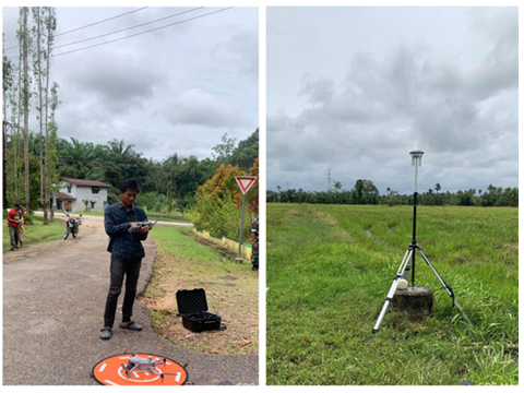
Geodetic Survey
- What
it is: The science of surveying and depicting the Earth’s surface,
focusing on its shape (the geoid) and gravity field. It involves
establishing a highly accurate, three-dimensional reference framework over
large areas. - Key
activities:- Defining
and maintaining geodetic reference systems and frameworks. - Marking
and surveying national borders. - Using
technologies like Global
Navigation Satellite Systems (GNSS) to monitor changes in the
Earth’s crust, such as plate motion and earthquake deformation.
- Defining
- Applications:
- Supports
mapping and Geographic Information Systems (GIS). - Provides
the high-accuracy control for property boundary surveys. - Used in disaster response to determine the effects of events.
- Supports
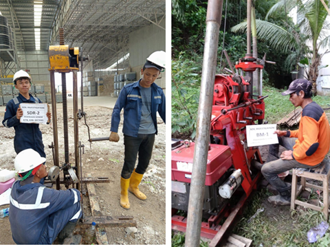
Geological Survey
- What
it is: A systematic examination of an area’s rock masses and mineral
resources to determine their character, distribution, and origin. It also
studies soil conditions and water resources.
- Key
activities:
- Mapping
the subsurface geology and identifying different rock types and
formations.
- Analyzing
the composition, structure, and history of the Earth’s crust.
- Acquiring
and processing data for applications like hyperspectral and thermal
research.
- Applications:
- Informs
spatial planning to create safe and livable areas by considering disaster
threats.
- Aids in the sustainable management of natural resources.
- Identifies communities vulnerable to geological hazards like earthquakes.